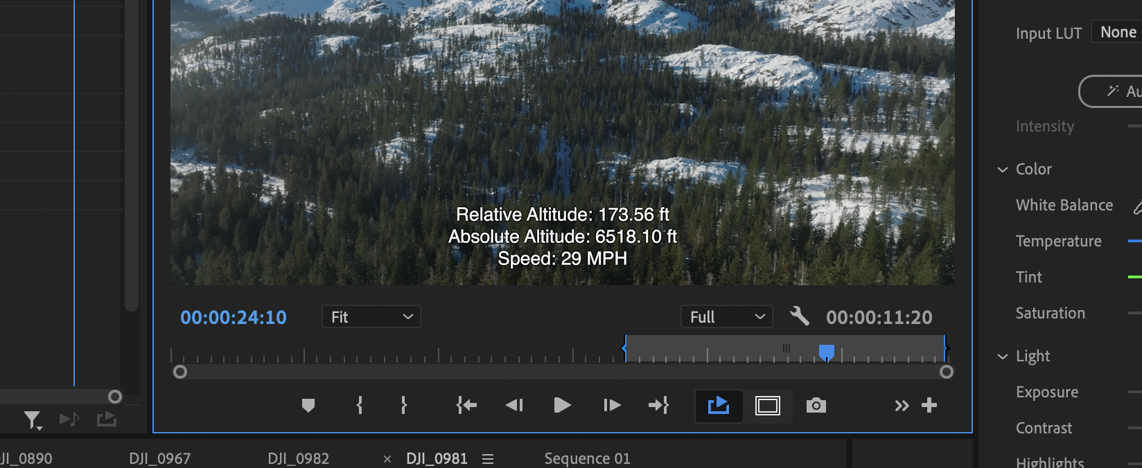
Aerial Metadata
Obtaining intelligible results from drone sidecar SRT.
When flying a drone, the onboard system records a wealth of data and stores it in a sidecar file known as an SRT file. For a long time, I didn’t pay much attention to these files—they felt like an overwhelming dump of information, much of which wasn’t relevant to my work. However, these files actively track numerous variables like aperture, shutter speed, and white balance. While these may be useful for some post-production workflows, my primary interest lies in a more focused set of metrics: latitude, longitude, and altitude.
Drones like the DJI Mavic 3 include two types of altitude data in their SRT files:
- Relative Altitude: Measured from the drone's launch point.
- Absolute Altitude: Measured relative to sea level.
When imported into software like Adobe Premiere Pro, these SRT files display a staggering amount of information that can feel like information overload. For me, the excess details didn’t mean much; all I really cared about were altitude and speed. Unfortunately, DJI's SRT files don’t include a direct parameter for speed.
To solve this, I created a Python script that processes SRT files to extract and simplify the relevant data. Here’s what the script does:
- Extracts Key Data: It pulls out latitude, longitude, and altitude from each frame in the SRT file.
- Calculates Speed: Using the differences in latitude and longitude across frames, the script calculates the drone's speed in miles per hour (MPH) over a smoother 48-frame window. This longer sample time ensures more accurate and stable speed readings.
- Generates a Simplified SRT: The output is a new SRT file that shows only:
- Relative Altitude (in feet)
- Absolute Altitude (in feet)
- Speed (in rounded MPH)
The result is a streamlined and readable file that updates less frequently, displays consistent values, and replaces “0 MPH” with a placeholder like “--” while the speed is being calculated. This is far easier to interpret during playback.
In a side-by-side comparison of the original DJI SRT file and the simplified version, the difference is night and day. The original file contains an overwhelming amount of data, while the simplified version focuses on the key metrics I need—altitude and speed—rounded to the nearest whole number for clarity.
This streamlined approach transforms the way I analyze drone footage. Whether you're a videographer, a drone hobbyist, or someone working with aerial data, simplifying your SRT files can provide meaningful insights without the clutter. The Python script not only makes the data digestible but also opens up new possibilities for understanding drone performance during flights.